Campus Maps
- Easily navigate the campus using Wayfinding at UBC Vancouver.
- To download printable maps, visit the Campus Maps page.
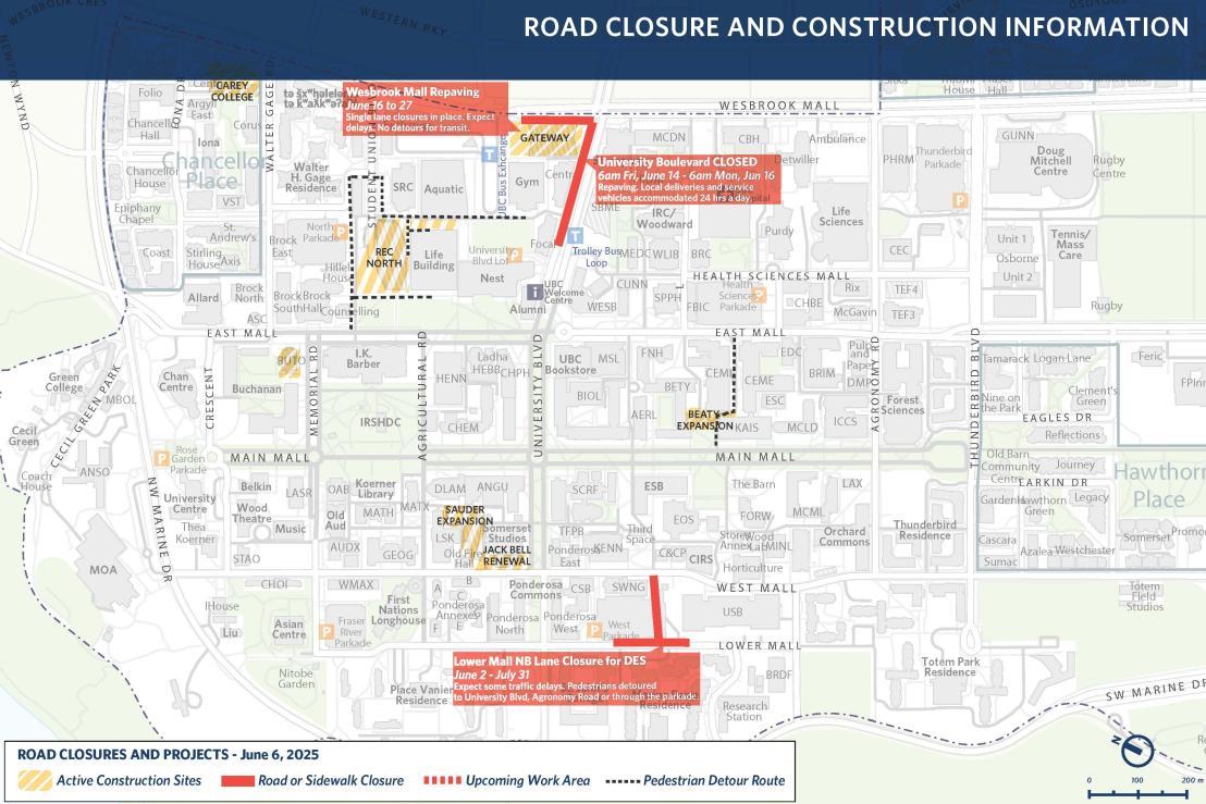
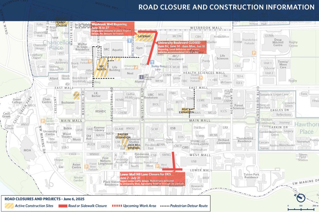
For detailed information on road closures on campus, see drop downs below. These are updated regularly but if you see something missing or have questions, email info.planning@ubc.ca.
Event related road closures and impact
Construction related road closures
Lot 26 Wesbrook Place
Construction for Lot 26 in Wesbrook Place will begin in October 2025 with a targeted completion date of November 2027. The demolition of the old sales office will commence on October 1st, 2025 and excavation activities for the new development will start on November 1st, 2025. All efforts will be made to minimize disruption to adjacent residents. Variances to construction hours will be permitted when absolutely necessary.
What to expect:
- Site access will be off of Ross Drive at Gray Avenue.
- Truck traffic is restricted to only use Ross Drive to Wesbrook Mall or 16th Avenue (not Gray Avenue).
- Staging area for materials will be at Ross Drive / Birney Avenue, which was also used for Lot 6 (Wordsworth).
- Sidewalks around the construction site will be closed for the duration of construction.
- Layby parking next to the site on Grey Avenue will be closed for the duration of construction for erosion sediment control tanks and to house the site office.

(click on image to enlarge)
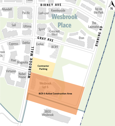
BCR6 - Wesbrook Mall and Binning Avenue
Development on the corner of Wesbrook Mall and Binning Avenue will have some impact on roads and traffic (see Development Projects page for project details:
- Binning Avenue east of Wesbrook Mall is currently closed to the general public.
- The sidewalk along the east side of Wesbrook Mall along the length of the construction site and the contractor parking will be intermittently closed for safety during construction activity. Pedestrians will be detoured to the sidewalk along the west side of Wesbrook Mall during this time.
- Parking along the east side of Wesbrook Mall will be intermittently closed to accommodate construction needs throughout construction.
- Nearly all construction related traffic are to arrive and depart the site to the south to reduce impacts on the community.