The Neighbourhood Plan
Wesbrook Place is a complete community, offering a range of housing types, including faculty and staff rental, and amenities and services that help meet the daily needs of local residents as well as the wider UBC community.
With about 5,400 housing units built, under construction or approved to proceed, the neighbourhood is about three-quarters complete. The remaining 2,100 units will be built over the coming decade in Wesbrook Place South, along with additional services, amenities and open space.
Visit the Development Projects page to stay up to date on new projects in the neighbourhoods and on campus
The Neighbourhood Plan for Wesbrook Place was adopted in 2005, and amended in 2011, 2016, 2020 and 2025. The plan outlines sustainability strategies, land uses and densities, parks and open space, circulation and transportation, design guidelines, development controls, infrastructure and servicing, and community facilities. The most recent update, completed in 2025, expanded the neighbourhood boundary to add Wesbrook Place South and updated the plan to better reflect Campus Vision 2050, the Land Use Plan, Housing Action Plan, Neighbourhood Climate Action Plan and other key policies.
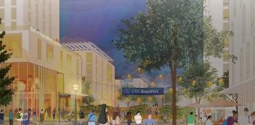
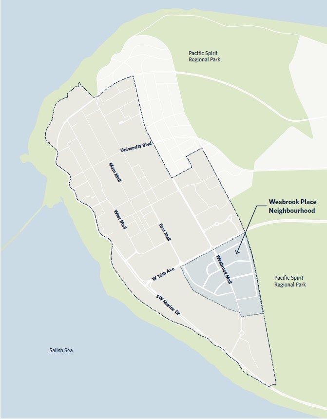
Above: illustration of completed Wesbrook Place. Top Right: Map of Wesbrook Place (click on images to enlarge)
Plan Highlights
Housing
The need for more UBC housing, amenities and services, green and open space and childcare emerged as prominent themes throughout Campus Vision 2050. In 2025 the neighbourhood plan was amended to enable additional housing, focused in Wesbrook Place South. When complete, the neighbourhood will have about 7,500 homes with an estimated population of about 16,200 people.
Housing in Wesbrook Place supports UBC’s campus-wide Housing Action Plan targets, including up to 40 per cent of new neighbourhood development as rental, up to 25 per cent as below-market faculty/staff rental, and up to 15 per cent as market rental for those who work or study on campus.
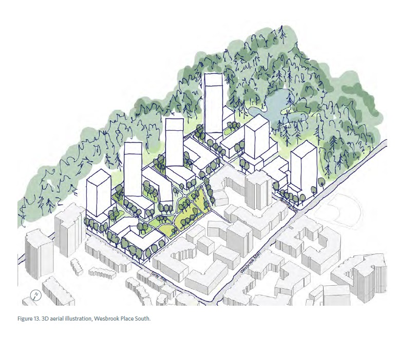
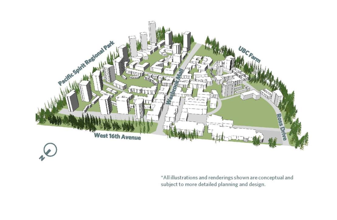
Illustration of Wesbrook Place South (click to enlarge).
Open Space
Wesbrook Place features numerous community parks and green spaces with a mix of formal and informal spaces for recreation, gathering, learning and teaching. Eight formal parks are distributed across the neighbourhood, featuring playgrounds, water features (which are integral to the stormwater management system), and recreational opportunities.
With the development of Wesbrook Place South, a new and unique ecological park at the south edge of the neighbourhood will protect and enhance local ecosystems, while offering access to nature and recreational and educational opportunities on campus, separate from Pacific Spirit Regional Park.
When complete, Wesbrook Place will have about 18.8 hectares of usable neighbourhood open space, or about 1.2 hectares per 1,000 residents.
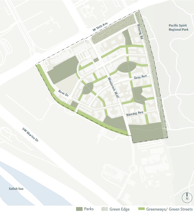
This map shows usable open space in Wesbrook Place (click on the image to enlarge).
Transportation
The Wesbrook Place transportation network includes:
- a network of local, shared streets that connect the neighbourhood with the rest of the UBC Vancouver campus and the wider region
- a system of connected pathways that enable pedestrian and non-motorized movement throughout the neighbourhood
- a recreational trail system that surrounds the neighbourhood and provides access to Pacific Spirit Regional Park
- local and regional bus routes
The 2025 update to the neighbourhood plan prioritizes walking, rolling, cycling and transit across Wesbrook Place through improvements to streets and intersections. These improvements will help address concerns about traffic, congestion and pedestrian and cyclist safety as the population grows.
Improvements enabled by the 2025 update to the neighbourhood plan, which will require ongoing coordination with the BC Ministry of Transportation and Transit as well as TransLink, include:
- A new north-south local transit route and a revised #68 bus route to enable higher frequency service
- Upgraded bike infrastructure, including a new separated bike path along Binning Road
- A new westbound left turn lane on West 16th Avenue at Binning Road, providing alternative access to the neighbourhood
- A new northbound right turn lane on the Wesbrook Mall roundabout at West 16th Avenue
- Replacement of pavers with asphalt on Wesbrook Mall to address maintenance and safety issues
- Consolidated underground parking for residents and visitors to minimize the number of driveways, improve safety of pedestrians and cyclists and create more space for trees and landscaping
Image
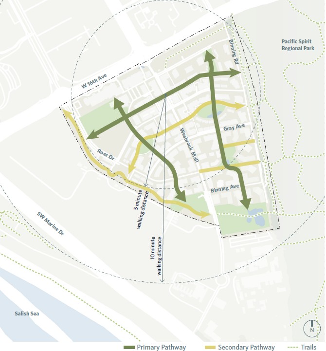
Map showing pedestrian routes in Wesbrook Place (click to enlarge) | Image
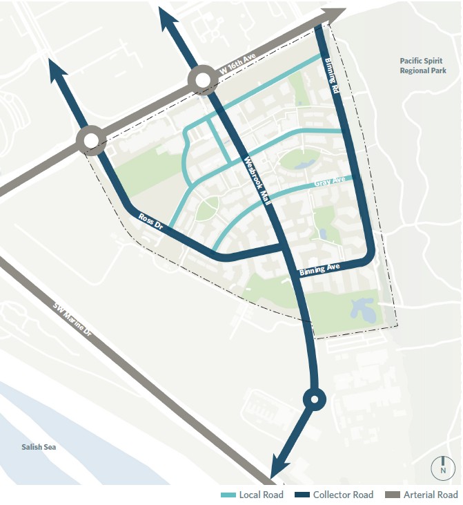
Map showing roads in Wesbrook Place (click to enlarge) | Image

Map showing transit routes in Wesbrook place (click to enlarge) |
Wesbrook Place Timeline
2005
Wesbrook Place Neighbourhood Plan adopted
Guided by the Official Community Plan adopted in 1997
2010
UBC Land Use Plan adopted
Replaced the Official Community Plan
2013
University Hill Secondary School opens
Relocated from Chancellor Boulevard
2015
Wesbrook Community Centre opens
Provides Wesbrook Place with fitness, recreation and event spaces
Summer 2019
South Campus Greenway receives Development Permit
Integrated between UBC Farm and the neighbourhood
2020-04-16
Minor Plan Amendment approved
Plan amended to reconfigure 4 lots to enable up to 500 faculty-staff units.
Starting October 2024
Wesbrook Neighbourhood Plan Amendment
UBC is engaging the community in a process to update the Wesbrook Place Neighbourhood Plan. The process and updates will focus on a new area of the neighbourhood, Wesbrook Place South, For more information on this process, click here.
2025
Wesbrook Place Neighbourhood Plan Amendment
Expanded neighbourhood boundary, creating Wesbrook Place South and enabling more housing, services, amenities, green and open space, and transportation improvements. The process included extensive design and technical work and engagement with the Wesbrook Place community.