Wesbrook Place Neighbourhood Plan Update
UBC is engaging the community in a process to update the Wesbrook Place Neighbourhood Plan. It is the first major step in implementing Campus Vision 2050, the long-range plan for how UBC's Vancouver campus will change and grow to support the needs of the university, its students, faculty, residents, staff, and Musqueam. The process and updates will focus on a new area of the neighbourhood, Wesbrook Place South, adding significantly more UBC housing over the next 10 years, new amenities, open spaces and child care, as well as transportation improvements in the surrounding neighbourhood area.

Overview
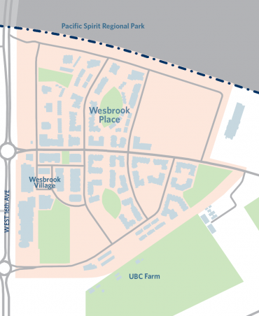
Located in South Campus, Wesbrook Place is bounded by West 16th Avenue to the north, Pacific Spirit Park to the east, and the UBC Farm to the west. Housing in Wesbrook supports the UBC community with 50% of all units designated as “work-study”, meaning that at least one member of the household works or studies on campus.
The planned buildings for Wesbrook Place are approximately 50% completed.
The Neighbourhood Plan for Wesbrook Place was adopted in 2005, and amended in 2011, 2016 and 2020. The Wesbrook Place Neighbourhood Plan outlines sustainability strategies, land uses and densities, parks and open space, circulation and transportation, design guidelines, development controls, infrastructure and servicing, and community facilities.
Download the Wesbrook Place Neighbourhood Plan
The Neighbourhood Plan
Wesbrook Place, UBC’s most ambitions neighbourhood plan to date, has set high standards for green building performance and UBC community housing provision. The Residential Environmental Assessment Program (REAP) is a UBC-specific green building rating system that was developed around the same time as Wesbrook Place Neighbourhood Plan and applies to all residential buildings in Wesbrook Place.
Some other prominent features of Wesbrook Place neighbourhood include:
- A high school
- A community centre
- Rental, family and seniors housing options, including faculty-staff rental housing
- A commercial town centre that includes a grocery store, restaurants, cafes, shops and services
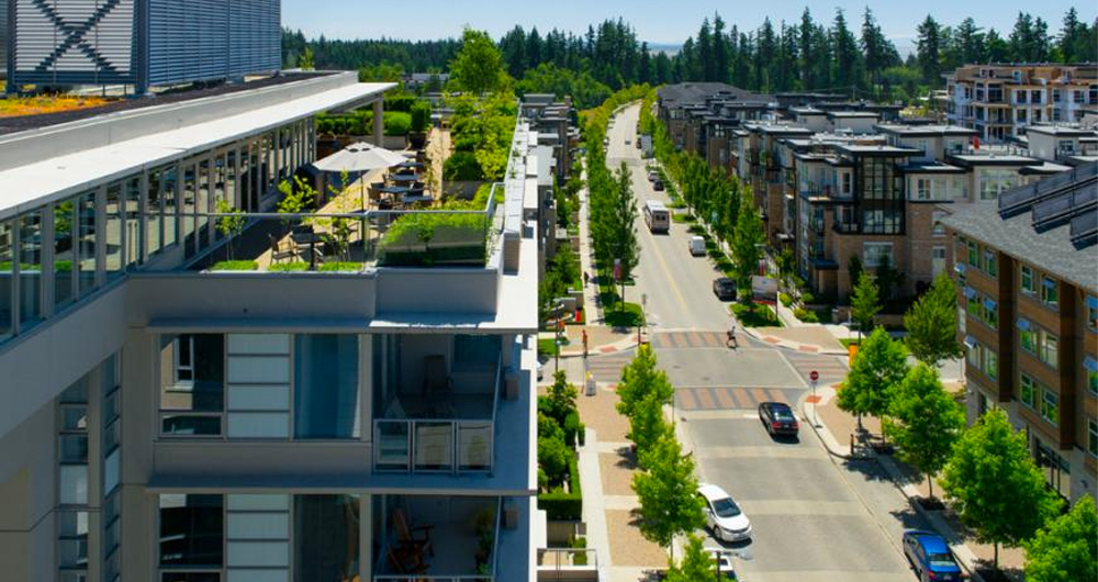
- Pedestrian friendly streets and paths
- Six local parks
Wesbrook Place Timeline
2005
Wesbrook Place Neighbourhood Plan adopted
Guided by the Official Community Plan adopted in 1997
2010
UBC Land Use Plan adopted
Replaced the Official Community Plan
2013
University Hill Secondary School opens
Relocated from Chancellor Boulevard
2015
Wesbrook Community Centre opens
Provides Wesbrook Place with fitness, recreation and event spaces
Summer 2019
South Campus Greenway receives Development Permit
Integrated between UBC Farm and the neighbourhood
2020-04-16
Minor Plan Amendment approved
Plan amended to reconfigure 4 lots to enable up to 500 faculty-staff units.
Starting October 2024
Wesbrook Neighbourhood Plan Amendment
UBC is engaging the community in a process to update the Wesbrook Place Neighbourhood Plan. The process and updates will focus on a new area of the neighbourhood, Wesbrook Place South, For more information on this process, click here.
